


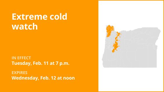
On Tuesday at 4:09 a.m., the National Weather Service issued an updated extreme cold watch for the North Oregon Coast Range Lowlands, North Oregon Coast Range, East Portland Metro, Outer Southeast Portland Metro, Clackamas County Cascade Foothills, Cascade Foothills of Marion and Linn counties, and Lane County Cascade Foothills. The watch was in effect from 7 p.m. until Wednesday noon.
The meteorological service warns of “dangerous cold wind chills as low as 5 to 10 degrees possible.” “The lowest wind chills will occur around the west end of the Columbia River Gorge Tuesday night into Wednesday morning.”
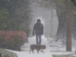
“Unprotected skin exposed to these temperatures will suffer from frostbite and hypothermia. According to the weather service, prolonged exposure to such low temperatures can result in hypothermia. Keep an eye on the most recent warnings and forecasts for any developments. Now is an excellent time to make sure you have warm outdoor clothing that will keep you warm in really cold weather and help you avoid hypothermia and/or frostbite. The easiest approach to stay warm in extremely cold weather is to wear multiple layers of clothing, such as outdoor jackets and pants, to assist prevent hypothermia and/or frostbite. Among these are a cap, gloves, a winter jacket, a face mask, thicker socks, and footwear appropriate for cold climates. Warmers for the hands and feet are also advised. Recreation in the backcountry is not recommended. If you must go outside, wear layers of clothing, including gloves, a face mask, and a cap. Pets should be kept indoors whenever feasible. Ensure that outside animals have access to food, water that isn’t frozen, and a warm, dry place to live. Check on elderly neighbors, family, and friends on a regular basis. Make sure you utilize portable heaters properly. Grills and generators should not be used indoors. To avoid frostbite and/or hypothermia, anyone preparing to go outside should exercise common sense and dress appropriately, covering any exposed skin. Be careful when you’re outside. Put on gloves, a hat, and clothes that are acceptable. Avoid staying outside in damp weather as this can make it more likely that the body will cool down and become hypothermic.
Understanding cold weather alerts
Be ready for extreme cold watch. When extremely low air temperatures or wind chill values are possible, an extreme cold watch is issued. As with a warning, change your plans so that you don’t spend the coldest hours of the day outside. Update your winter survival gear and make sure your car has at least half a tank of gas left.
Warning: Extreme cold: Act now! When dangerously low air temperatures or wind chill values are predicted or already occurring, an extreme cold warning is issued. Avoid venturing outside if there is an extreme cold warning in effect. Make sure at least one other person is aware of your whereabouts, wear layers if you must go outside, and cover any exposed skin. When you reach your destination safely, update them.
Warning of cold weather: Exercise caution. When seasonably cold air temperatures or wind chill values—but not exceptionally severe ones—are anticipated or happening, a cold weather advisory is issued. When you and your loved ones go outside, make sure you cover any exposed skin and wear suitable clothing.
United Robots offers a service called Advance Local Weather Alerts that gathers the most recent information from the National Weather Service using machine learning.